laneBoundarySegment
Description
Add-On Required: This feature requires the Scenario Builder for Automated Driving Toolbox add-on.
The laneBoundarySegment object stores lane boundary information
for a road segment, in world coordinates.
Creation
Syntax
Description
lbsegment = laneBoundarySegment(boundaryIDs,boundaryPoints)laneBoundarySegment object, lbsegment,
initialized with boundary points boundaryPoints for its associated
boundary IDs boundaryIDs. The boundaryIDs
argument sets the BoundaryIDs property, and the
boundaryPoints argument sets the
BoundaryPoints property, of the returned
laneBoundarySegment object lbsegment.
lbsegment = laneBoundarySegment(___,Name=Value)
Properties
Object Functions
plot | Plot lane boundary points |
resamplePoints | Resample lane boundary points |
smoothBoundaries | Smooth lane boundaries |
addBoundaries | Add lane boundaries to lane boundary segment object |
removeBoundaries | Remove lane boundaries from lane boundary segment object |
updateBoundaryPoints | Update lane boundary points of existing lane boundaries |
updateBoundaryIDs | Update IDs of lane boundaries in lane boundary segment object |
alignBoundaryPoints | Align lane boundary points in lane boundary segment object |
getLanesInRoadRunnerHDMap | Create RoadRunner HD Map from lane information |
Examples
Load lane boundary data into the workspace.
data = load("laneBoundarySegmentData.mat","ids","points");
Display the lane boundary IDs and their associated lane boundary points.
boundaryIDs = data.ids
boundaryIDs = 4×1 string
    "3"
    "1"
    "2"
    "4"
boundaryPoints = data.points
boundaryPoints=4×1 cell array
    {128×3 double}
    {128×3 double}
    {128×3 double}
    {128×3 double}
Create a lane boundary segment object.
lbsegment = laneBoundarySegment(boundaryIDs,boundaryPoints)
lbsegment =
  laneBoundarySegment with properties:

       BoundaryIDs: [4×1 string]
    BoundaryPoints: {4×1 cell}
      BoundaryInfo: []
     NumBoundaries: 4
         NumPoints: 128
      GeoReference: []
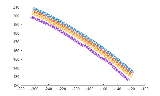
Plot the lane boundary segment object.
plot(lbsegment)

Load lane boundary data into the workspace.
data = load("laneBoundarySegmentData.mat","ids","points","info");
Display the lane boundary IDs, their associated lane boundary points, and the additional lane information.
boundaryIDs = data.ids
boundaryIDs = 4×1 string
    "3"
    "1"
    "2"
    "4"
boundaryPoints = data.points
boundaryPoints=4×1 cell array
    {128×3 double}
    {128×3 double}
    {128×3 double}
    {128×3 double}
boundaryInfo = data.info
boundaryInfo=4×1 struct array with fields:
    Type
Specify the geographic coordinates of the lane boundary origin.
geoRef = [0 0 0];
Create a lane boundary segment object that includes the additional lane information and geographic origin.
lbsegment = laneBoundarySegment(boundaryIDs,boundaryPoints,BoundaryInfo=boundaryInfo,GeoReference=geoRef)
lbsegment =
  laneBoundarySegment with properties:

       BoundaryIDs: [4×1 string]
    BoundaryPoints: {4×1 cell}
      BoundaryInfo: [4×1 struct]
     NumBoundaries: 4
         NumPoints: 128
      GeoReference: [0 0 0]
Plot the lane boundary segment obejct.
plot(lbsegment)
Tips
To obtain
laneBoundarySegmentobjects from your tracked lane boundaries, use theegoToWorldLaneBoundarySegmentsfunction.To group adjacent lane boundary segments using boundary connections, use the
laneBoundaryGroupobject.
Algorithms
The first point of a lane boundary represents the start of the lane segment, and the last lane boundary point represents the end of the lane segment.
If the specified lane boundaries do not all have equal numbers of points, then the
laneBoundarySegmentobject resamples the lane boundaries so they all have the same number of points as the specified boundary with the greatest number of points.This object uses the Piecewise Cubic Hermite Interpolating Polynomial (PCHIP) method to interpolate the lane boundary points by using the
pchipfunction. If the x- or y-coordinate values of the lane boundary points do not increase or decrease monotonically, then the PCHIP fit might produce an unrealistic lane boundary shape.
Version History
Introduced in R2024a