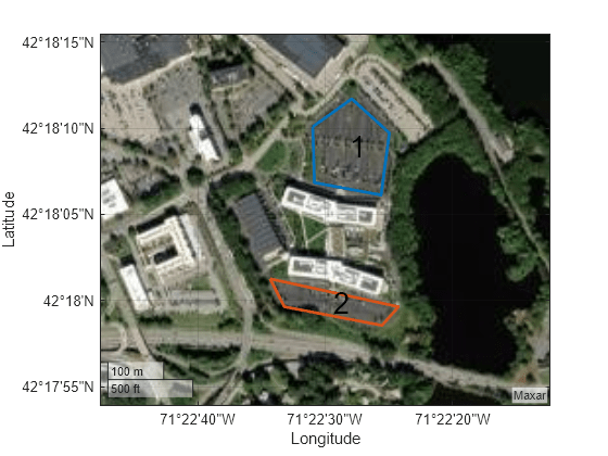
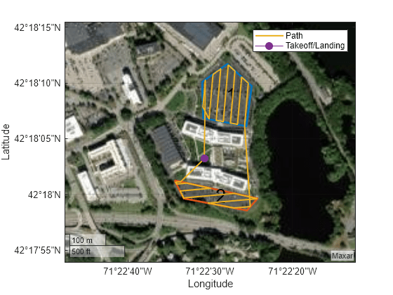
This example shows how to plan a coverage path that surveys the parking lots of the MathWorks Lakeside campus.
Get the geodetic coordinates for the MathWorks Lakeside campus. Then create the limits for our map.
Create a figure containing the map with the longitude and latitude limits.
Get the outline of the first parking lot in longitude and latitude coordinates. Then create the polygon by concatenating them.
Repeat the process for the second parking lot.
Create the coverage space with both of those polygons, set the coverage space to use geodetic coordinates, and set the reference location to the MathWorks Lakeside campus location.
Set the height at which to fly the UAV to 25 meters, and the sensor footprint width to 20 meters. Then show the coverage space on the map.
Set the sweep angle for polygons 1 and 2 to 85 and 5 degrees, respectively, to have paths that are parallel to the roads in the parking lots. Then create the coverage planner for that coverage space with the exhaustive solver algorithm.
Set the takeoff position to a location in the courtyard, then plan the coverage path.

