projfwd
Project latitude-longitude coordinates to x-y map coordinates
Description
[
transforms the latitude-longitude coordinates specified by x,y] =
projfwd(proj,lat,lon)lat
and lon to the x and
y map coordinates in the projected coordinate reference
system specified by proj. Specify proj
using a projcrs
object (since R2020b), a map projection structure, or a GeoTIFF
information structure.
Examples
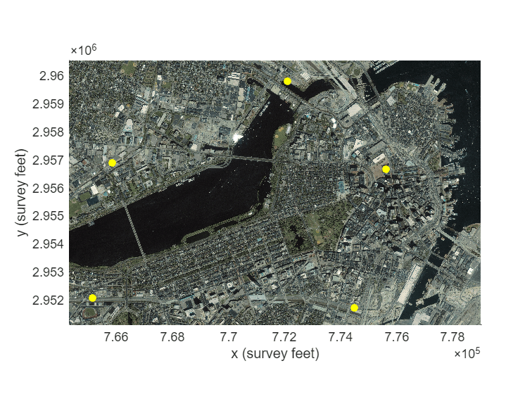
Project latitude-longitude coordinates to x-y coordinates by specifying a map projection. Then, display the projected coordinates on a map.
To do this, first specify the latitude and longitude coordinates of landmarks in Boston. Specify the coordinates in the NAD83 geographic CRS.
lat = [42.3604 42.3691 42.3469 42.3480 42.3612]; lon = [-71.0580 -71.0710 -71.0623 -71.0968 -71.0941];
Then, import a GeoTIFF image of Boston as an array and a map cells reference object. Get information about the map projection by querying the ProjectedCRS property of the reference object. Verify that the geographic CRS underlying the projected CRS is NAD83.
[A,R] = readgeoraster("boston.tif");
proj = R.ProjectedCRS;
proj.GeographicCRS.Nameans = "NAD83"
Project the latitude-longitude coordinates to x-y coordinates using the same projected CRS as the GeoTIFF image.
[x,y] = projfwd(proj,lat,lon);
Display the GeoTIFF image and the projected coordinates on the same map. Change the marker symbol and color of the coordinates so they are more visible. Then, add axis labels.
mapshow(A,R)
mapshow(x,y,DisplayType="point",Marker="o", ...
    MarkerFaceColor="y",MarkerEdgeColor="none")
xlabel("x (survey feet)")
ylabel("y (survey feet)")
Input Arguments
Output Arguments
Tips
If the geographic CRS of lat and lon does
not match the geographic CRS of proj, then the values of
x and y may be inaccurate. When
proj is a projcrs object, you can find its
geographic CRS by querying its GeographicCRS property. For example,
this code shows how to create a projcrs object from EPSG code 32610 and
find the associated geographic CRS.
proj = projcrs(32610);
proj.GeographicCRS.Name
ans =

    "WGS 84"