20 results

A MATLAB toolbox for exporting publication quality figures

Overlays rasterized text on an image matrix.

Better looking Matlab figures with anti-aliasing!

convert an ArcMap raster to a 3-column xyz file
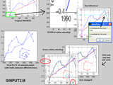
Same as GINPUT but with ZOOM, PAN and (optionally) PLOT and image SCALE/GEOREFERENCE!

MATLAB Code for Creating a Mesh from a Bitmap Image
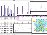
Anakyze spike trains exported from multi-electrode arrays
ESRI ASCII grid read/write
Save a MatLab array in a typical ArcInfo ascii raster, with header at top.

Import Arc/Info AsciiRaster
convert ARC ASCII text file to xyz
Write gridded data set in Arc ASCII Grid Format

Generate X Y Z coordinates of a 3D Bresenham's line between two given points

Filter to introduce spatial autocorrelation while keeping original distribution.
Performs neural spike pattern analysis on extracellular potentials acquired with TDT's System3.

Mex file interface for reading various raster image formats, optionally providing georeferencing.
Package of functions for an ASCII raster GUI object.

combine response raster for single trial

a library of matlab functions for raster (spatially referenced gridded) data

You can also select a web site from the following list
Americas
- América Latina (Español)
- Canada (English)
- United States (English)
Europe
- Belgium (English)
- Denmark (English)
- Deutschland (Deutsch)
- España (Español)
- Finland (English)
- France (Français)
- Ireland (English)
- Italia (Italiano)
- Luxembourg (English)
- Netherlands (English)
- Norway (English)
- Österreich (Deutsch)
- Portugal (English)
- Sweden (English)
- Switzerland
- United Kingdom(English)
Asia Pacific
- Australia (English)
- India (English)
- New Zealand (English)
- 中国
- 日本Japanese (日本語)
- 한국Korean (한국어)