insertPointCloud
Insert 3-D points or point cloud observation into map
Syntax
Description
insertPointCloud(
inserts one or more sensor observations at the given map3D,pose,points,maxrange)points
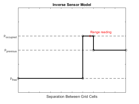
in the occupancy map, map3D. Occupied points are updated
with an observation of 0.7. All other points between the sensor
pose and points are treated as
obstacle-free and updated with an observation of 0.4. Points outside
maxrange are not updated. NaN values
are ignored.
insertPointCloud(___,
inserts a point cloud with updated probabilities invModel)invModel
that correspond to obstacle-free and occupied observations. Use any of the
previous syntaxes to input the point cloud.
![Figure contains an axes object. The axes object with title Occupancy Map, xlabel X [meters], ylabel Y [meters] contains an object of type patch.](../../examples/nav/win64/Create3DOccupancyMapAndInflatePointsExample_01.png)
![Figure contains an axes object. The axes object with title Occupancy Map, xlabel X [meters], ylabel Y [meters] contains an object of type patch.](../../examples/nav/win64/Create3DOccupancyMapAndInflatePointsExample_02.png)
![Figure contains an axes object. The axes object with title Occupancy Map, xlabel X [meters], ylabel Y [meters] contains an object of type patch.](../../examples/nav/win64/Create3DOccupancyMapAndInflatePointsExample_03.png)
