Mapping for Mobile Robots and UGV
From the series: Modeling, Simulation, and Control
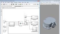
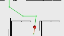
Discover how to create occupancy grids from different sources after collecting environment information using various robot sensors. You’ll also learn how to use ROS-enabled systems with MATLAB® and Simulink® to generate and simulate maps that you can use for developing autonomous navigation algorithms such as path planning and control.
Autonomous systems such as mobile robots and unmanned ground vehicles require digital representations of their environments to navigate effectively. Occupancy grid objects provide versatile representations that interact with existing motion planning, control, and localization algorithms. After watching this video, you'll be able to use MATLAB to map robot environments from either individual numerical arrays, images, or lidar scans with the SLAM Map Builder app.
Published: 7 Oct 2021
Related Products
Learn More
Select a Web Site
Choose a web site to get translated content where available and see local events and offers. Based on your location, we recommend that you select: .
You can also select a web site from the following list
How to Get Best Site Performance
Select the China site (in Chinese or English) for best site performance. Other MathWorks country sites are not optimized for visits from your location.
Americas
- América Latina (Español)
- Canada (English)
- United States (English)
Europe
- Belgium (English)
- Denmark (English)
- Deutschland (Deutsch)
- España (Español)
- Finland (English)
- France (Français)
- Ireland (English)
- Italia (Italiano)
- Luxembourg (English)
- Netherlands (English)
- Norway (English)
- Österreich (Deutsch)
- Portugal (English)
- Sweden (English)
- Switzerland
- United Kingdom (English)
Asia Pacific
- Australia (English)
- India (English)
- New Zealand (English)
- 中国
- 日本Japanese (日本語)
- 한국Korean (한국어)